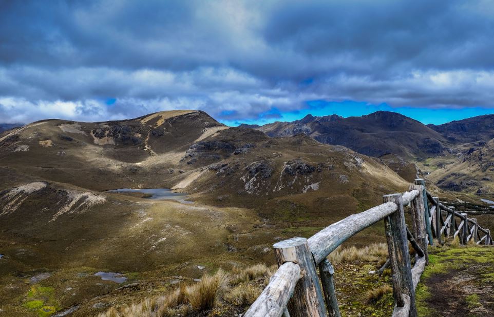

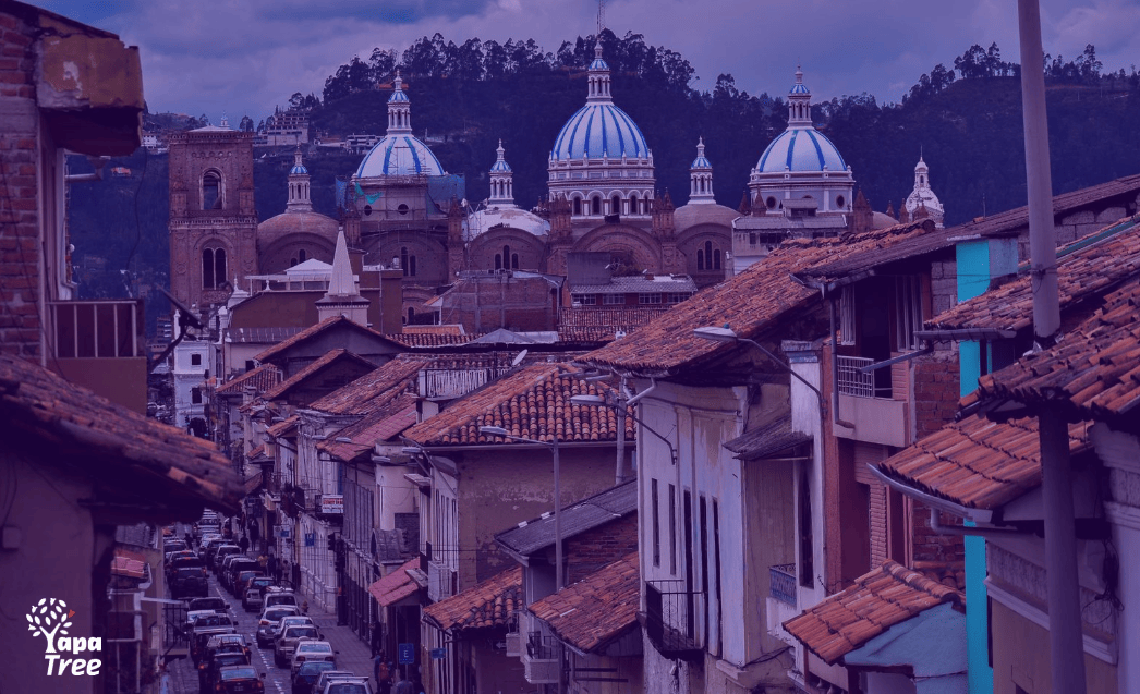
One of the “must see’s” for any visitor to Cuenca should be Cajas National Park. A large percentage of the people who visit Cajas National Park tend to make a classic rookie mistake: they hear about it and decide that they want to visit this unparalleled gem of nature and once they get there, they realize that they didn’t give themselves much time to do any research in advance so, they end up with a big, beautiful, fascinating scenery in front of them and no clue as to what to do next. With a park so vast, it seems like it would take a serious investment of time and effort to really experience what it has to offer, but even a short trip to Cajas National Park can be rewarding if you know how to make the most of your time.
[color-box color=”gray”]In this article we will cover:
Brief History of the National Park
The Basics; Including Location, Hours of Operation, Cost and How To Get There
Cajas Tips
Points Of Interest:
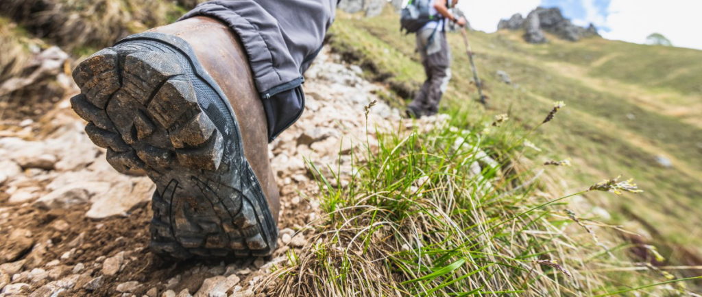
1. Hiking
2. Fishing
3. Camping
4. Fauna
5. Flora
Things You Might Like To Know
[/color-box]
Brief History
Between the years 500 to 1450, the Cañari people formed a federal alliance whose population worshipped the Moon, lakes and mountains and considered the territories of the Park to be sacred places up until the Inca’s conquered the region.
The “Inca Trail” crosses the Park and is a vestige of the road linking Tomebamba with “Tambo de Paredones” (Molleturo), on the strategic route between the highlands and the coast. 4 km of this road were restored and can be transited within the Park, between the Luspa cave and the Mamamag lagoon.
The Park was created on July 4, 1977 and was declared a national park on May 11, 1996
Back To The Top
The Basics
Location: Cajas National Park is located in the Andes, in the South of Ecuador, in the province of Azuay, 33 km to the Northwest of the city of Cuenca.
Visiting hours: 08H00 to16H00
Cost: Free (unless you want to spend the night in which case it’s $4 for foreigners and $2 for locals)
Getting there: The park is located northeast of the city of Cuenca. To access the area, it is necessary to take the road that connects Cuenca to the coast: Cuenca-Molleturo-Naranjal. This road crosses the Park in the northern area and from there, you can access a vast majority of lakes and lagoons, as well as the centre of information interpretation on the banks of the Toreadora Lagoon. Another alternate third order route is located to the South of the Park and is known as Soldados-Angas.
Back To The Top
Cajas Tips
Dress Comfortably
Comfort trumps style when it comes to Cajas National Park. Decide on a pair of shoes that you won’t regret eight hours later. It’ll probably be pretty cool (if not outright freezing) specially in the morning and after dark; wear a warm sweater, hat and sunglasses, and carry a jacket and scarf in your backpack for those unpredictable chilly winds.
Extra tip: Pack an extra pair of socks as you can find yourself ankle deep in certain puddles or streams.
Pack Accordingly
You’re planning for a day at Cajas National Park, not a week in the desert, so don’t bring more than you can comfortably sling over your shoulder. Don’t forget sunscreen to protect exposed skin from those pesky UV rays and make sure to bring a reusable water bottle. Consider stashing a sandwich and a few small preferably healthy snacks in your bag too, as trails can be very long and it’s not likely that you’ll have time to go back to your car or a restaurant just for lunch. Although signal is a bit difficult to come by specially in the deeper trails, a backup phone battery or charger is a good idea, as well.
Extra tip: Consider turning off your data or going into airplane mode, to keep your phone running all day.
Register
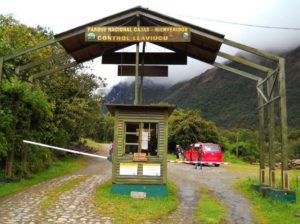
I know all you want to do is to start exploring as soon as possible but I can’t stress this enough, you must register! when you first drive or walk into the park, there’s a small booth where you can register in the visitor’s log. This is a very important step as it lets authorities will know that you’re there in case of an emergency.
If you would like to view some maps of the popular hiking trails you can find them at the Cajas National Park website.
//
Points Of Interest
Hiking
Hiking routes across the park, range from short ones of an hour or two to end to end treks that could take you up to two or three days. A topographic hiking map of Cajas will be of great help if you want to plan your hiking routes beforehand.
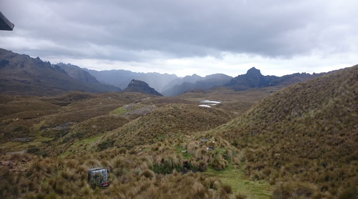
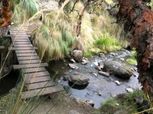 The most popular hike starts at the Information Centre and it takes you northeast past Lake Toreadora, through a quinua forest and down past Lake Totoras and Lake Patoquinuas. The trail ends back at the highway, around 8km east of the Information Centre, at the Quinuas checkpoint, where you can catch a bus back to Cuenca if that’s where you’re headed. If you’re not familiar with the paths, ask the warden to assign you a tour guide to show you one and guide you through it (recommended).
There are many possibilities for day hikes, so consult the park map and ask for guidance. Preparation is essential! There is always the possibility of thick fog and/or rain obscuring your visibility so always prepare for a worst case scenario: bring emergency food, water and ideally a survival blanket even on short day hikes. Hey, better safe than sorry right?
Fishing
In the lagoons you will find a vast amount of fish, specially trout; it’s meat never fails to delight the local or foreign palate, and can be caught by oneself. At the entrance to the National Park, specifically in the sector of Dos Chorreras, there are more than 15 businesses dedicated to this activity, which complete their excelent service with cabins, delicious cuisine and recreational activities like hiking, horseback riding, cycling, among others.
It is said that this activity dates back to 1951. Lake Toreadora, being next to the main path, is the most popular for sport fishing enthusiasts.
Camping
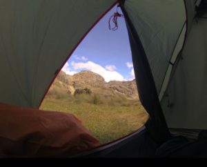 If you decide to camp by one of the lakes, make sure your tent is well sealed or you’ll have a cold, wet and miserable time. It’s driest between June and August, but you never know, it might rain, hail or snow at any time of the year. Take plenty of blankets and layers of clothing as temperatures at the Park range between -2 to 18 ° C. The weather can quickly change and you can find yourself in the middle of frosts, drizzle, fog and even intense sunny days. While planning for your trip, take a look at the cautions and advantages of living at elevation to make sure that your health is not at risk.
Fauna
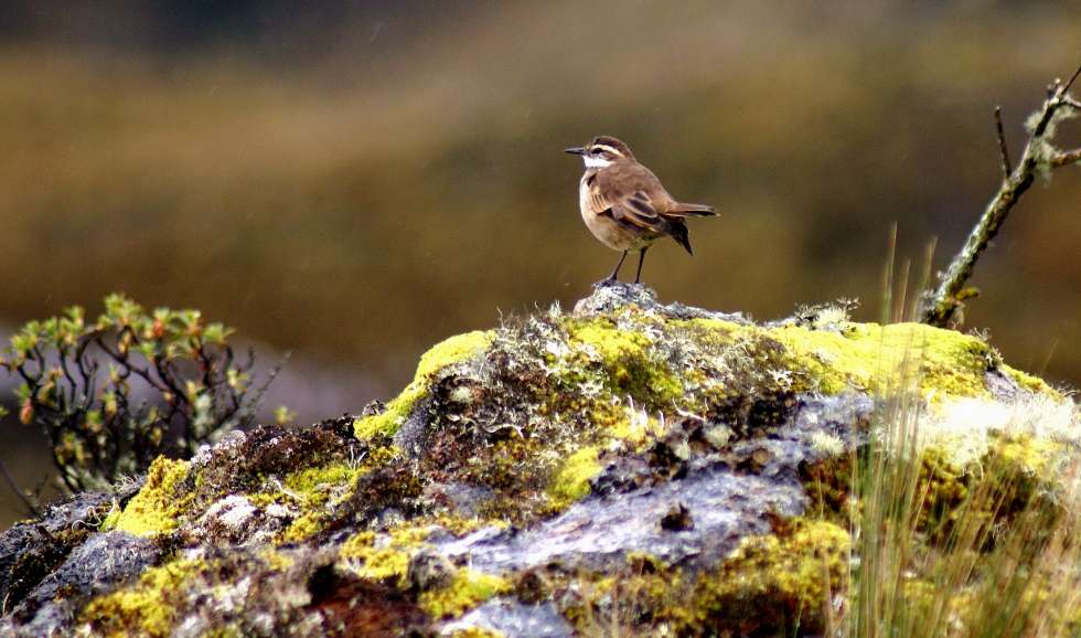
The fauna at Cajas National Park is made up of: 152 species of birds, 43 species of mammals, 15 species of amphibians and 4 species of reptiles. The animals which tend to be observed more often in the Park are rabbits, ducks and trout. In addition, there are white tail deer, bears, pumas, Andean tapir, Andean gulls, condors and other local species.
Flora
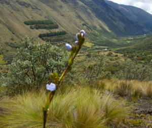
The vegetation at the Park mainly consists of tree and shrub species along with a great diversity of orchids, ferns and mosses. At the other end of the park there are many timber species as well.The most common plant species are Rosemary,”Valeriana”, Quinoa (which is a native tree of the Park), characterized by its twisted trunk and branches.
Back To The Top
Things You Might Like To Know
• The Ministry of the environment incorporated Cajas National Park to the national system of Protected Areas of Ecuador, since it possesses outstanding archaeological features, values and exceptional qualities that are part of the national goals of preservation and protection of valuable cultures.
• There are volcanic rocks from the Cretaceous and Pleistocene age. In the area, geological characteristics represent the Mesozoic and Quaternary periods.
• Pay Avilahuayco a visit: It serves as a natural viewpoint or Watchtower; the panorama which can be seen from its summit is unique as it allows you to see the “boxes” that dominate the entire area.
• Don’t forget Laguna Taitachungo: The Toreadora splits from the lagoon and there are some trails that lead straight to it. From this place you can pass by the Ingañan or the Inca Trail toward the Luspa Cave.
• Information brochures and maps of the Park are provided at the offices of the Ministry of the Environment and in ETAPA.
Back To The Top
And Finally: Be Safe & Enjoy
Sure, we’re all explorers at heart, but don’t get carried away and wander off deep into the Park without a sense of direction and risk not being able to get back safely. If you just can’t help yourself, make sure to have an experienced guide accompany you and you’re good to go! Enjoy the amazingly unique and unforgettable experience that is visiting and scouting Cajas National Park and breaking free from society and every day life for a day or two to enjoy this magical place. I assure you, you won’t regret it.


9 Responses
Carolina – Do you have more details on where to pick up or buy a physical map of the park and trails? Great article! Thank you.
The last time I came through the Cajas I was able to pick up a map at the registration booth when I was entering. They aren’t always a guarantee though…
As a regular backpacker, i know the importance of a good map and compass. I would like to do a 2-3 day through hike of the park. Is there anyway to get a map in advance so that i can plan a route and figure out where the water sources are? Also, are the trails r easonably well marked?
There are printable maps on the Cajas National Park Website.
Hey guys, you can download the maps here http://parque-nacional-cajas.org/tracks.html I have also gone ahead and included the link in the write-up for future readers!
Thanks! I love having the elevation profiles, too!
The website Neil has provided above is your best bet for the map!
The trails are not marked but the maps come with a color guide that will take you through them! If you’re not at all familiar with the trails, I recommend walking or hiking with a tour guide who will lead the way and get you back safely.
I found the trails to be confusing, quite poorly marked. The map at park headquarters was practically useless. Get a good map shard of time. And take a compass.
If you ask for a guide at the registration desk, how much does it cost.